Spent the day snowshoeing in the Campcardos Valley recently. This valley is at the Western boundary of the Catalan Pyrenees Regional Nature Park - a beautiful part of the Eastern Pyrenees where Pyrenees Mountain Adventure mainly operates.
The Pyrenees run along the border between France and Spain but also Andorra. In two places the borders of the 3 countries meet at a single point. One of the points is the Pic de Médécourbe and the other is at the head of the Campcardos Valley at the Porteille Blanche/Portella Blanc (White Col).
The walk starts near to the village of Porta which was at one time
heavily reliant on smuggling. This is no surprise given it's closeness
to Andorra and the ease of access provided by the Campcardos Valley. It
was mainly tobacco that was smuggled out of Andorra but also other
contraband. Smugglers being pursued found it easier to escape being
caught because of the border junction. Depending on which country the
chasing police were from, the smugglers had a choice of two countries in
close proximity to escape into.
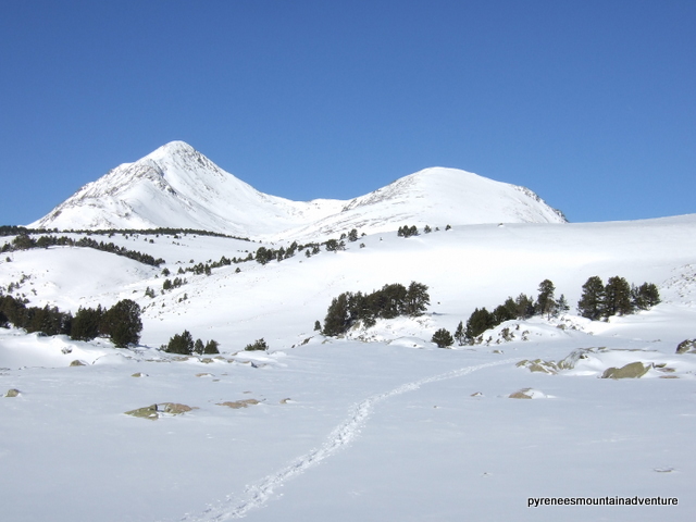
 |
| The head of the Campcardos Valley |
Walking along the valley, one side is in shade (ubac) and is covered with trees - the biggest and highest silver birch forest in the Pyrenees-Orientales. The other side is exposed to the sun (soulane or adret) and is much more open. The large number of dry stone walls that form enclosures, the terracing to provide areas of flat land and the stone shelters with turf roofs (orris) all indicate that the valley has been used as summer pasture for animals for centuries.
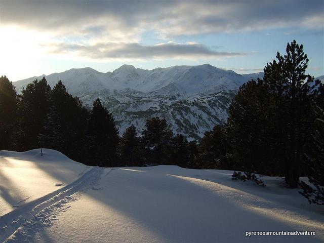
When I reached the col (where the border marker number 427 was buried under the snow) it was easy for me to step briefly into each of the 3 countries.
 |
| Walking along the border between Andorra (left) and France (right) |
The HRP (Haute Route Pyrenean), the high level long distance footpath that crosses the whole Pyrenees from (Atlantic) Ocean to (Mediterranean) Sea, passes over the col.
The GR107 (GR = Grande Randonnée) is another long distance footpath that also passes over the col. This is the
Cathar Way. The Cathars were members of a Christian breakaway religion popular in the 12th and 13th centuries. The Catholic Church treated the Cathars as heritics, persecuting them and burning many at the stake. The persecuted Cathars were able to lead a more peaceful existence in Spain where many of them escaped, passing from France to Spain along the Campcardos Valley and others like them in the eastern Pyrenees.
The
Cathar Way is a 220-kilometre-long route from the French
medieval town of Foix over the Pyrenees to Berga in Spain and is broken down into 12 days.
 |
| Unusual cloud formation over Pic Campcardos |
Walking up and down the valley there were good views towards the second highest peak in the Catalan Pyrenees Regional Nature Park - Pic Campcardos (2905m) I could see the route to it from the valley although in winter with snowshoes and the icy conditions it might be easier to approach it from Spain. A pyrenees mountain adventure for another day!


.JPG)